
Ecological Connectivity
Enhancing Ecological Connectivity in the Thompson Watershed
Why This Project Matters
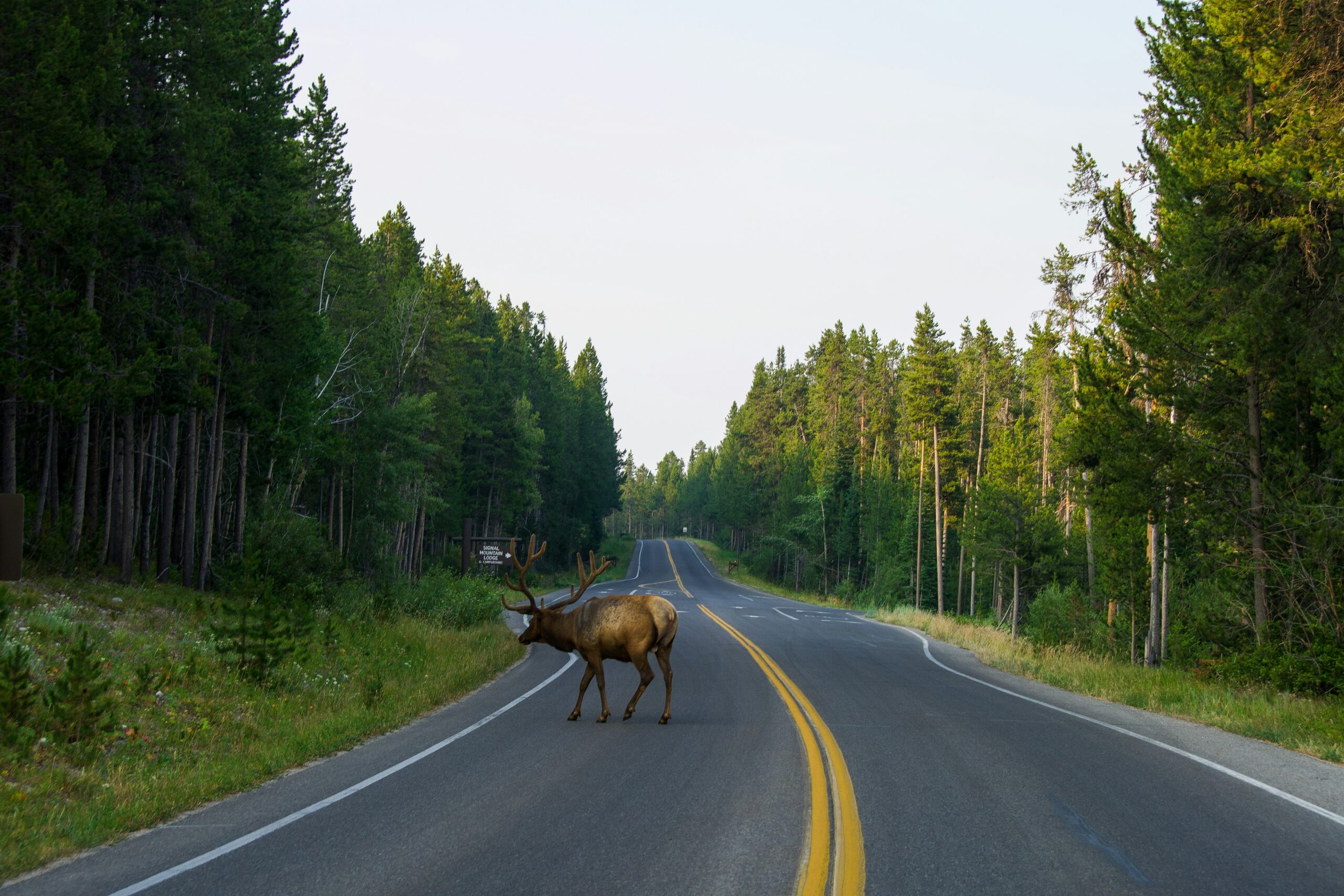
The ongoing loss of ecological connectivity, driven by habitat fragmentation from urban and industrial development, roads and railways, recreational land use, and climate change, negatively impacts wildlife populations through increased mortality and reduced productivity. This poses a significant threat to biodiversity, wildlife movement, traditional practices, food security, and cultural integrity. The First Nations Territories within the Thompson region are home to as many as 60 species at risk, as well as culturally significant terrestrial species such as mule deer, caribou, grizzly bears, moose, elk, and salmon, all of which require connected landscapes for survival.
Project Approach
Through this project, we are committed to:
- Ensuring Indigenous Knowledge and priorities guide all conservation efforts, and that their ownership and control of this information remain secure.
- Integrating Western science and Indigenous Knowledge to develop accurate habitat connectivity maps for culturally and ecologically important species.
- Identifying key ecological corridors that support species movement and ecosystem resilience.
- Providing information and data to support enhanced conservation planning, including potential regional policy development.

Railways and highways intersect with key wildlife corridors across the region. As part of this project, TNCC is exploring how linear infrastructure impacts wildlife movement and identifying opportunities to support safer passage for species across the landscape.
Anticipated Benefits of This Project
This project has the potential to provide multiple benefits for participating Indigenous communities, including:
Land and resource management planning
It can be utilized to strengthen Indigenous-led land use and sustainable resource management plans by identifying and protecting critical habitats and aligning with Traditional Ecological Knowledge.
Wildlife conservation and management
It can inform targeted conservation and Indigenous-led management plans for culturally significant species by identifying key corridors and barriers and incorporating traditional harvesting and conservation practices.
Cultural heritage protection
It can be utilized to identify and protect culturally significant areas connected to wildlife movement, integrating Indigenous Knowledge into conservation planning.
Addressing cumulative effects
The information can be used to assess cumulative effects from past land use and develop mitigation strategies for future land use that include restoration activities.
Informing policy and industry practices
The project's findings can provide a valuable evidence base for engaging with regulatory bodies and industry, potentially initiating the incorporation of landscape-scale connectivity considerations into regional planning and development practices to address fragmentation and support restoration efforts.
This project is supported by the Government of Canada, including Environment and Climate Change Canada and Parks Canada – National Program for Ecological Corridors.

This project has also been made possible thanks to support from the following:
